Diego Vergés: The Mentawai

Photo © Diego Vergés-All Rights Reserved

Photo © Diego Vergés-All Rights Reserved

Photo © Diego Vergés-All Rights Reserved


As I indicated in an earlier post on The Travel Photographer blog, Diego Vergés is back from his 4 months trip to Indonesia (and PNG) and its various islands, and is currently working feverishly on his inventory of images.

He tells me that he has so far edited and readied only one of his expected 8 or more photo essays on the various indigenous groups of Indonesia, and that's the gallery on the Mentawai. The images are spectacular, and I encourage you to view them as they provide a window into a culture which I suspect will soon vanish.

You'll notice Diego's characteristic lighting techniques from the above photographs, and which he told he learned from The Strobist. Photographing the Mentawai, he used off camera lighting, a reflector and a softbox. For cameras, Diego uses a Canon 5d and a 5d Mark II, with prime lenses (24mm f1.4 and 50mm f1.4).

The Mentawai are the native people of the Mentawai Islands, which is a chain of about seventy islands and islets off the western coast of Sumatra. They live a semi-nomadic hunter-gatherer lifestyle in the coastal and rain forest environments of the islands, and number about 64,000. They are known by their deep spirituality, body art and the tradition of sharpening their teeth for beautifying reasons.

The Mentawai practice traditional animism, and as with other indigenous cultures, are threatened by encroaching modernism.

The Rock of Dunamase is one of my favourite sites in Ireland, and another that doesn't get the visitor numbers it deserves. The first historical reference to the Rock of Dunamase came from the Annals that record it being plundered by Viking raiders in 843 AD. But the site was extensively refortified after the Norman invasions of Ireland, the site was said to be part of the dowry given by Diarmuid MacMurrough when his daughter Aoife, married the leader of the Norman Invasions Richard de Clare (Strongbow). 
The Rock is superbly situated on a prominent height above the lowlands of Laois

It was again a wedding gift, when Aoife and Strongbow's daughter married William Marshall. He carried out extensive works at the Rock and lived there from 1208 - 1213. Again through marriage the Rock passed to the powerful Mortimer family.

After the Mortimer lands were confiscated by the Crown in 1330, the Rock of Dunamase was given to the O'Moore family but it was left abandoned. It is likely that the site was 'slighted' (basically blown up) by Cromwellian Generals Hewson and Reynolds in 1651. 


The imposing gatehouse at the Rock of Dunamase

During the late 18th Century, it had become fashionable to romanticise and restore old ruins such as these at the Rock of Dunamase, and Sir John Parnell, Chancellor of the Irish Parliament (and great-grandfather of Charles Stewart Parnell) bought the Rock. He tried to construct a banqueting hall on the Rock and even brought in many of the later medieval features (such as window frames) from other historic sites. Parnell died before the work was completed, and the site was allowed to fall back into ruin by his son. 


Today the Rock of Dunamase is owned by the OPW, and is one of the most atmospheric sites to visit in Ireland, with stunning views across the landscape. It is free to enter, but do take care during poor weather conditions as the steep paths may become slippery.


It is located near Port Laois, about an hours drive from Dublin City Centre.


Enjoy a great day out with stunning views at the Rock of Dunamase

Google Brings Street View To U.S. And Canadian National Parks

I've always been a big fan of Google's Street View technology. It's the amalgamation of the excellent Google Maps and photos that are taken and geo-tagged at various locations around the planet. The results are that we can explore a map from above then with a simple click, zoom down to street level to see exactly where it is we'll be traveling. It can be tremendously useful when visiting a place for the first time and it is often fun to explore an area right from your computer.

For some time now Google has been using the Street View tech to map some really cool locations. For instance, you can visit the Galapagos Islands, the Great Barrier Reef and even Everest Base Camp directly from your browser. But today, the Internet search giant has announced that by working with the U.S. National Park Service and Parks Canada, 44 national parks have been added to Street View as well, allowing us to take a virtual escape to those destinations even when we don't have time to actually go ourselves.

Some of the locations that been added include Sequoia National Park, Joshua Tree and Mt. Rushmore. You can also pay a visit to such historical landmarks as the Alamo, the Lincoln Memorial and the National Mall in Washington DC. If you're looking to head north of the border, check out Moraine Lake and Lake Louise in Canada's Banff National Park as well.

Of course, I'd never even begin to suggest that Street View is a viable option for going to visit these places for yourself. It is however, fun technology that allows you to scout ahead before you actually go in person. It is also a nice way to escape the office, even if for just a few minutes, during a particularly long and boring day. It is also a nice reminder of how far we have come in terms of mapping technology. I hope Google continues to expand on these initiatives in the years ahead.

Think Tank Multimedia Buyer's Guide

Photo Courtesy Think Tank

I don't have any Think Tank products (except for its see through bag for cables and stuff), but I must say that it's one of the companies that seems to be in lock-step with the industry's evolution with multimedia.

Here is it's latest effort in the multimedia field which is the Multimedia DSLR Buyers Guide. It's essentially a fluff piece about various products that can be used by photographers as additional tools for story-telling purposes. While some of the information is pretty basic, I found it quite useful when I got to the Accessories and Wired It Up sections. Naturally, Think Tank also lists its various bags as "must-haves" in the guide, and deservedly so.

As readers of this blog know, I do not advertise products of any kind, unless I've tried and liked them. I haven't tried Think Tank bags but I like what it's doing with its product line. Otherwise, I have no relationship of any sort with it.

The Rest of Everest: Bonus Episode - LUNGevity Team Breathing Strong


Earlier today the LUNGevity Team summited Everest, using O2 but without Sherpa support, and in tribute to them Jon, over at The Rest of Everest has released a Bonus Podcast with a brief Q & A with the team.

Jon met up with the guys while in base camp while he was in Tibet at the beginning of April. He talks with both Brian Oestrike and Justin Hewitt about what lay ahead for them on the climb and what their expectations were for going up above 8000m for the first time.

The latest new from their blog says that the guys are back in C2, exhausted, but happy and in good spirits. Brian and Justin were climbing to raise money and awareness for lung cancer, a noble cause for sure. Congratulations on a job well done guys!

If you're looking for a regular episode of The Rest of Everest, be patient. Jon promises us a new one tomorrow. But the news of LUNGevity topping out was too big not to share.

Kilimanjaro Climb: Machame Route - Day 4


Barranco Camp (3950m) to Barafu Camp (4550m)

First off, apologies for not getting this posted sooner, but real life has prohibited me from doing updates as often as I would like over the past week or two. I'm hoping things will return to normal this week.

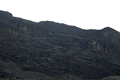
The theme for Day 4 is "Up!" as that's what you'll be doing all day. Climbing up. There are a series of long, continues climbs throughout the day, beginning with the Barranco Wall (seen in the picture above) which will be the focus of your first hour to hour and a half for the day. You'll break camp after breakfast and after a short walk across the valley, you'll begin tackling the wall, which is about 1500 feet tall. There is a fairly well defined path up the Wall, but you'll still find yourself doing some non-technical rock climbing/scarmbling at times. When you glance over your shoulder, you'll aslo have some amazing views, but it is also a long way down. It's best to just keep focused on the trail and continuing the cimb to the top. This is one of the tougher parts of the climb prior to Summit Day.

After you top out on the Barranco Wall you'll follow the path down a short descent into the Karanga Valley and the trail will wind about in a much easier fashion for a time. You'll still have to watch the rock scree and mind your balance on the descent, as you will begin to encounter some icy rocks and slick surfaces. The going is fairly easy for an hour or so until you'll run into another tough, challenging climb that is very vertical. While it's not as long, nor as challenging, as the Barranco Wall, it is pretty much straight up the side of the mountain, and it's certainly no walk in the park. At the top, you'll break for lunch however, and the break, along with the hot meal and tea will help to re-engergize the legs.

After lunch, it's another long, slow, steady climb to Barafu Camp. The trail up is fairly bleak and desolate, as you're well into the alpine desert once more, with little to see except for rocks and dry soil. Glancing up will give you a nice view of the summit, and you'll also have amazing views of both Kibo and Mawenzi peaks. The glaciers are also in full view and it's important to sneak a peek at the scenery from time to time, as you'll mostly be focused on putting one foot in front of the other, and following your guides up the trail.

The rest of the afternoon is a bit of a slow, challenging slog up the side of Kilimanjaro. You won't encounter the steep, vertical walls that you faced eariler in the day, but the trail will continue to climb for the next few hours, with little relief. Shortly before you reach Barafu Camp you'll have to scramble up and over more rocks and boulders before finally reaching the end of the march for the day.

Barafu is quite barren and rocky and is the last camp before your summit push, and while there is little to see around the camp itself, the views of the summit and the area around the mountain can be quite stunning. You won't get too much time to enjoy them however, as you'll have an early dinner, and then off to the tent for some much earned rest before departing at mid-night for the summit.

For me, Day 4 was the day that my lack of sleep finally caught up with me. The night before I probably had 20-30 minutes of light dozing, so at this point of the climb I was probably going on about 8 total hours of sleep in about six or seven days, dating back to when I left the States. Despite that, when I left the tent that morning, I felt strong and ready to go. Surprisingly so in fact. However, by the time we topped out on the Barranco Wall, I could tell that my energy levels were not where they needed to be. The second long climb, just before lunch, took it's toll on me as well, but lunch and the hour long break helped to get my legs back under me, but once again, I could tell that I wasn't bouncing back the way I had on the other days so far.

The final straw was the long, slow, afternoon climb. It was quite a challenge for me to continue up the mountain, and by the time I reached Barafu Camp, I knew that I wasn't going to be going up to the summit. That afternoon exhaustion set in and I'd never felt so weary as I did when I finally reached camp. I was running on reserves, and all I wanted to do was climb into my tent and sleep. Unfortunately, sleep was the one thing I couldn't do. Even as exhausted as I was, I couldn't sleep. Over dinner, I discussed the way I was feeling with the guides, and while they encouraged me to continue the climb, I knew that it was in my best interest to not push myself further. Getting to the top was only part of the equation, getting back down ws not going to be easy either, and I had a full week of safari ahead of me too, and running myself ragged or getting sick was not an option. I was certainly disappointed in the way I felt, but deep down inside, I knew it was the right choice.

While I was exhausted, that didn't mean that I wasn't aware of the beauty of our surroundings. The views were spectacular and the summit looked amazing. We were also treated to a strong snow storm for an hour or two, that was a nice change of pace from the damp mist and rain from the lower portions of the climb. The wind was quite strong and ruffled the tents, and while it was cold, it wasn't uncomfortably so. The gear I had brought along served it's purpose quite well, and were it not for the lack of sleep, I'd have been looking forward to the summit.

Viking and Medieval Dublin, City Tour

Have you ever wondered how Dublin got its name? Or where medieval Dubliners went for a pint? Read on to discover just some of Dublin’s medieval past that is still visible today!


Imagine you could travel backwards in time in Dublin, and strip back the glass, metal, concrete and tarmac of the modern city to replace it with timber, wattle, thatch and stone to see what Dublin was like over a thousand years ago.

Dublin is a city of two names, the first of which comes from the early medieval period. There was a natural island in the middle of the River Liffey which became the main crossing point of the river. At low tide the river at the island became so shallow that mudflats were exposed, the early Dubliners lay down interwoven branches of saplings over the mudflats and these mats or hurdles allowed people and animals to cross the river and gave the area it’s Irish name Ath Claitha - The Ford of the Hurdles. This original fording point of the Liffey is thought to be located close to the Brazen Head pub which is on Bridge Street, close to Merchant Quay.

Prior to the Viking settlement, a monastery had been established close to where Trinity College stands today. The monks called the area Dubh Linn, Gaelic for Black Pool, as a large murky pool formed where the River Poddle met the Liffey. The Vikings kept this name, calling it Dyflinn in their Norse language, when they chose this spot to be their first Longphort or overwinter camp in 841 AD. The Vikings chose this area as it possessed many natural defensive advantages. This first overwinter camp laid the foundations for the development of the modern city of Dublin.
A tenth century Viking returns to Wood Quay to find a few changes....

Wood Quay

The site that is synonymous with Viking Dublin is Wood Quay. Once the heart of one of the largest Viking settlements in the world, unfortunately much of this settlement was lost forever when Dublin City Council constructed the large concrete offices of the Dublin Corporation Offices. The story of Wood Quay was a long and complicated issue involving archaeologists, politicians, local councillors, international experts, senators, the courts and over 20,000 outraged members of the public. The fight to save Wood Quay continued throughout the 1970s and into the 1980s but ultimately the development went ahead.

So why was the site at Wood Quay so important? The preservation of the archaeology at the site was almost unparalleled, and it offered amazing insights into the Viking and later Norman settlement. The archaeologists discovered quay fronts where the ships used to moor to offload their goods, numerous houses, shops, and craft and textile manufacturing areas and a large amount of artefacts that informed us about what people ate, how they dressed, how they worked and even how they lived and died in Dublin over a thousand years ago. Many of these artefacts are now on display at the National Museum of Ireland, on Kildare Street.

The Viking settlement excavated during the Wood Quay saga mainly represented the second phase of Viking settlement in Dublin dating to the tenth and eleventh centuries.
A feature of the site was the many waterfronts and revetments which held back the waters of the Liffey, and the old Norse wall which has been reconstructed and is on display within the civic offices.


Winetavern Street, Fishamble Street and Cook Street


Winetavern Street is one of many street names that tells us what was happening in this part of Dublin during the Viking, Hiberno Norse and medieval periods. One of the most common finds from this area of the Wood Quay excavation was tavern tokens. They look like small coins but are units of currency and could be used in the taverns that used to line this street during medieval times to buy a cup of wine or ale. These taverns developed during the eleventh and twelfth centuries. Fishamble Street gets its name from all the fish markets that were once held there. It is an ideal location for a fish market due to its proximity to the LIffey, and Cook Street was the area of Dublin where all the bakers sold their breads, pies and pastries. They had to sell their goods outside of the city walls as so many fires would have posed a considerable risk to the city with its tightly packed timber houses.
A late twelfth century Norman foot-knight at Cook Street

On Cook Street you can find a surviving portion of the medieval walls that once enclosed the city, with the only functioning medieval gate in the city walls at St. Audoen’s Arch. This wall has been modified over time, particularly in the early twentieth century. It now runs for 90 metres and stands approximately 7 metres in height. The original wall is thought to have been commissioned by the great Brian Boru’s grandson – Muirchertach O’Brien in around 1100 AD. After the Anglo-Norman captured Dublin at the end of the twelfth century, they quickly began a programme of refortifying the old viking walls. They also reclaimed large areas of land from the Liffey. This area was once prosperous and settled by wealthy merchants. The large gateway you can see at St. Audoen’s allowed them to access the port and their warehouses.


St Audoen’s Church

St. Audoen's Church
Constructed at the western side of the medieval city wall, St. Audoen’s dates to the late twelfth century, although it may stand on the site of an earlier church as a ninth century graveslab was found on the site. The church was dedicated to St. Ouen (or St. Audoen) of Rouen, the Patron Saint of Normandy. The church was extended and modified many times over its history. The first phase was completed by around 1200 AD. The church was a simple two celled design, with a nave and a narrower chancel. The entrance of the building was through the decorative moulded doorway that was carved in a typical late-Romanesque style. In the early years of the thirteenth century, the second phase of the church saw the chancel and nave combined to create one large room.

The next phase in the early fourteenth century saw major modifications at St. Audoen’s, with the development of an elaborate four bay arcade creating a new nave that nearly doubled the size of the church, following that a fifth bay was constructed in the arcade and a new chancel. The original Romanesque doorway was moved to a recess in the western end of the church where it can still be seen today. In the fifteenth century a four storey bell tower was constructed at the western side of the church. This tower houses large bronze bells, one cast in 1423, making them the oldest church bells still in use in Ireland. Extensive excavations of the site were carried out in the 1990’s and they revealed a wealth of information about the site. Today St. Audoen’s is an OPW heritage site and is a wonderful (and free) place to visit. For opening hours see here http://www.heritageireland.ie/en/dublin/staudoenschurch/
Christchurch Cathedral
Christchurch and St. Patrick’s Cathedral
Christchurch Cathedral was originally founded in around 1028 AD and was commissioned by the Hiberno-Norse King Sitric Silkenbeard after he had completed his pilgrimage to Rome.
St. Laurence O’Toole was elected abbot of Dublin in 1162, and became instrumental in saving Dublin City from being sacked by the Anglo Normans, who had been employed by the King of Leinster, Diarmuid Mac Murrough as mercenaries to win back his lands from rival Irish Kings. Laurence was a reformer and strongly believed the Irish church needed to be modernized and changed. He worked diligently from Christchurch and attended many negotiations with the key political figures of the time. In 1180 St. Laurence succumbed to a long illness while on pilgrimage in France. His body was buried in France, but his heart was sent back to Ireland. Encased in a heart shaped iron box it became one of Irelands most famous relics. Laurence was canonized as a saint 45 years after his death and the relic of his heart was placed in Christ Church cathedral with sprigs of mountain heather from Glendalough around it. It survived many persecutions, the most serious being the Reformation which was initiated by Henry VIII in the 1540s. Henry ordered that all relics in Christchurch be taken to Skinners Row (across the road) and burned. Many famous relics were destroyed including the true staff of Jesus which was famed throughout the country for its healing powers, yet Laurence’s heart remained untouched, until March 3rd 2012 when it was stolen from the Cathedral. Its whereabouts are still unknown. In the 1180’s the Christchurch that we are familiar with today began to take shape. John Cumin, the first Anglo-Norman arch bishop, had Christchurch reconstructed in stone in the fashionable Romanesque style of the time.

For entry fees and opening hours please visit http://www.christchurchdublin.ie/Visitors/Visitor-Information.htm\
St. Patrick's Cathedral

Dublin is rather unusual as it has two cathedrals situated very close to one another. St. Patrick’s Cathedral was constructed on the site of an earlier church in the twelfth century and consecrated as a cathedral on St. Patricks Day 1254. Like Christchurch, St. Patricks has changed dramatically over the centuries, particularly in the nineteenth century when the Guinness family carried out a programme of conservation and renovated and reconstructed the crumbling building into the fine cathedral it is today, see http://www.stpatrickscathedral.ie/index.aspx for more details.

Dame Street


Located on the very eastern most edge of the medieval city, Dame Street takes its name from a large dam that was constructed here across the River Poddle in the medieval period. This dam maintained the depth of water around the Castle and city walls.

Medieval Dublin was small, it was said that you could walk from one side of the city to the other in less than ten minutes, but despite its small size it was densely packed, by the thirteenth century it was thought that the population of Dublin exceeded 10,000. Wealthy Dubliners lived in tall houses that could reach three stories in height. The tall houses made the streets dark and dank, with no rubbish collection people simply threw their waste out of the windows. The streets would have been full of dogs, cats, rats and pigs feeding off the waste. Such unsanitary compact living led to epidemics like the Black Death breaking out and causing devastation to medieval Dubliners. A particularly bad outbreak in 1348 is thought to have killed hundreds. People were buried in mass graves in an area of Dublin still known as the Blackpitts today.


Dublin Castle


The area on which Dublin Castle stands today was part of the early Viking settlement in Dublin. As the population grew, the Vikings constructed a fortified wooden fence or palisade to protect the settlement from raids from the neighbouring Gaelic Irish kingdoms.
Dublin Castle
After the Normans seized control of Dublin, King Henry II visited his newly acquired territories. He left forty of his knights to defend Dublin. They refortified the south-eastern corner of the old Viking fort, the area that faced onto the pool in the River Poddle. The original Norman defences were probably an earthwork castle rather than stone, but in 1204 the King ordered a stone castle to be constructed on the site. There was a great need for strong defences for Dublin. The growing settlement was surrounded on all sides by Gaelic kings and chieftains who would relish the chance to raid this settlement of foreigners. This was highlighted by a savage attack that became known as Bloody Monday. On Easter Monday in 1209, a number of the Anglo-Norman citizens of Dublin ventured out to an area known as Cullenswood where modern Ranelagh stands today. They hoped to enjoy the weather, spending the afternoon picnicking and hunting in the fresh air away from the cloying stink of the city. Unbeknownst to them, a band of Gaelic warriors, probably led by the O’Byrne and O’Toole families, saw their opportunity and descended on the unaware citizens. They massacred around 500 people in a bloody and savage attack.

Following this the work on the city defences was accelerated, with the Castle being completed by around 1230 AD. The castle was surrounded by a deep moat, with imposing high stone walls and large circular towers at each corner. The Castle has changed dramatically from its medieval origins. It was severely damaged by a fire in 1684, and was largely demolished in the eighteenth century to make way for today’s castle. Only one tower from its medieval past still stands above ground, and the Black Pool which originally gave Dublin its name has now become the Castle gardens.
A FitzGerald halberdier from the sixteenth century


These are just a few of the echoes remaining of Viking and Medieval Dublin. We have produced an audioguide to help navigate you around the City and to highlight in more detail the incredible heritage that still surrounds us. Our guide is packed with original music and sound effects, and helps to bring to life the story of the early Dubliners. It costs just €1.99 and is available from http://abartaaudioguides.com/our-guides/viking-and-medieval-dublin-audio-tour (follow the link for a free preview). If you’d like to discover more about Medieval Dublin I recommend paying a visit to the superb (and free to enter!) National Museum of Ireland on Kildare Street, and Dublinia opposite Christchurch, where you can come face to face with Dublin’s medieval past.

This is the first of my articles on cities, heritage towns and villages. If you know of a great site near you please leave a comment below.

The historical re-enactment photoshoot was with Claíomh. All photographs © abartaaudioguides.com

Revisiting Commonwealth Crescent Food Centre

Yu Sheng

I wasn't intentionally trying to come here a second day in a row. But I needed to run an errand nearby, and we figured that we'd get some breakfast here before moving on. This time the porridge lady was open, so I grabbed her yu sheng. And now I remembered why I liked it so much: that lovely bouquet of cilantro, ginger, and spring onions sitting in the center, all seasoned with sesame oil and a dusting of white pepper. I never tried her porridge, but the yu sheng is right up there with Joe Pork Porridge and Ah Chiang.

And oh yeah - unfortunately I didn't care that much for the soup version of Jian Kiang's wantan mee, as the broth was sweet, and they still ended up loading it up with that dried up char siu. Well, I suppose it's like trying to get New York pizza in Chicago: just stick to the local version instead. I guess that means I'll be going for the dry version here. And if I really get the cravings for HK-style noodles while still being on the equator, then the Noodle Place will get me by.

Book Review: The Eiger Obsession


I've been teasing a book review for The Eiger Obession since before I left for Africa. There is something to be said for a 28 hour (One way!) travel time for helping you get caught up on your reading. Here are my thoughts on the book...

The Eiger Obession by John Harlin III is an interesting dichotomy of parts. On the one hand, it's a biography of Harlin's father, John Harlin II, who was an amazing climber in the Alps during the 50's and 60's, and on the other hand it's an auto-biography of Harlin III himself, and his life following his father's death on the Eiger back in 1966. Finally, it's the story of a son, following in his father's footsteps, to silence some demons, and even breakout from a long shadow, and form his own identity.

John Harlin II was pilot for the U.S. Airforce stationed in Europe during the 1950's. He was tall, athletic, and very charismatic. He was also a climber of no small skill, and he loved the Alps. They were practically his own personal playground, and over the years, he put up new routes, and climbed all the major peaks in the range. He became a legend in the European climbing community and even earned the nickname "The Blonde God". There was one route however that Harlin hadn't conquered, but continued to have dreams of completing: The Eiger Direct. Up until that time, there was only one route up The Eiger, the biggest, baddest face in the Alps, and it wandered all over the wall until it reached the top. Harlin wanted to put up a straight route, a more direct route. So, in 1966 he went after that route, with a team of excellent climbers I might add, but in doing so, he lost his life when a frayed rope broke while he was on it. In the end, the team reached the top, and the route was called the "John Harlin Route", but his death had profound consequences on the people who knew him.

The second half of the book follows Harlin's son, John Harlin III, as he grows up and becomes quite a good climber in his own right. However, along the way, he can always feel the shadow of his father over him, as other climbers question his abilities and accomplishments. And of course, always looming over him, is The Eiger itself, which he finally faces for an upcoming IMAX film entitled The Alps. Upon conquering The Eiger, Harlin III at last puts some of those demons to rest.

The book itself is very well written and does a good job of mixing the biographical and autobiographical elements. Harlin III, who is no stranger to writing and editing, paces the book nicely, and you'll find that it's quick and easy to read, while still offering all the details and information necessary to tell the story it needs to. He also does a fine job of walking the fine line of being an adoring son, who remembers his father in one light, while still examining the way others saw him as well. Harlin II was known to exaggerate the truth from time to time, and other climbers found him to be a bit of prima donna or poser on the mountain, and yet the author acknowledges those elements in his father, without losing his own boyish admiration that many of us can relate to with our own fathers.

The book is also a nice history of The Eiger itself. Harlin gives us plenty of background on the mountain that became the stage for both his father, and in due time, himself. It's probably the most famous face in the Alps, and while it's been climbed numerous times, it still remains iconic to this day.

In the end, The Eiger Obession is a very satisfying read. It's a well told story of two men, father and son, who climbed for different reasons, but shared much more than just a name. I enjoyed the book all the way through, and would highly recommend it to climbers and non-climbers alike. The story is compelling and told in such a way that anyone can enjoy it. It should also make a great companion to The Alps when it's released to IMAX theaters soon. The book would also make a great Father's Day gift in a few months as well, and will make a fine addition to anyone's personal climbing library.

I've got another book finished that I'll be reviewing soon as well. Something of a completely different nature, but just as enjoyable for very different reasons.

Two Climbers Fall In The Grand Teton National Park

National Pars Traveler has posted a very sad article about two climbers who fell in Grand Teton National Park. Apparently they fell while climbing on Sunday and were reported missing yesterday. When rangers went looking for them, they spotted the bodies, but as of this time they can't be reached due to unsafe conditions in the area. The names of the climbers are being withheld at this time. (Thanks for the heads up Carl!)

It's been a rough week on the climbing community. First we had word on Lara Kellogg, and yesterday The Adventurist posted this story with the terrible news that both Andi Orgler and Kasper Ochsner died on separate climbs. And if that wasn't enough, ExWeb has reported that Italian climber Sergio Dalla Longa has fallen to his death on Dhaulagiri.

It's a rash of accidents like these that makes you realize that mountaineering is still a very dangerous activity, and that the places we go can be very unforgiving. Keep the friends and familes of these fallen comrades in your thoughts this week, and keep your fingers crossed that they are the last fatalties we'll have to report on for a good long while.
Fish

It was definitely unintentional to come to Fresh Station yet again. But a group of us needed a relaxing dinner that didn't require much effort, and this place was within easy reach on a Friday night. We got a different set than what we got last time though. And I have to confess that this place is really growing on me now, especially after seeing them use a blowtorch to melt tuna belly fat and let it drip onto bara chiraishi.

EATING OUT IN BUENOS AIRES-- CHILA, A GREAT NEW ARGENTINE RESTAURANT

I rented an apartment in Buenos Aires so I could get the feel for living here. Every morning I prepare breakfast, pretty much the same stuff I have in L.A. I go shopping at a supermarket, Disco, and at small vegetable stores. Today I had half a white melon, very much like a honeydew, stuffed with blueberries, strawberries, pecans, lemon juice. I also prepare my own lunches. Dinners find me going out to try Argentine restaurants. When I get home I'll do a whole story on the health food scene and on the vegetarian restaurants I found-- and I´m pretty sure I've found 'em all. But today I want to write up a review of a haute cuisine restaurant my favorite concierge suggested. It's new and not in any of the guide books yet.

In fact, the whole area isn't in any of the guide books yet. The restaurant is called Chila and the area is Puerta Madera. It is the newly gentrified docks region and, man is it ever gentrified! No old word charm here, except there were two three-mast naval schooners docked along the bank and a full navy band playing a concert. The area looks real snazzy and upscale and with a grotesque combination of TGI Friday and Hooters on one side of the river and glistening highrises, complements of ABN-AMRO, Hilton, Nextel, LG, and lots of construction cranes dominating the other side, it's just the kind of area I'd steer clear of. But then I would have missed Chila.

The concierge had helped me trick the rotten Brazilians out of a visa and I wanted to celebrate with a wonderful dining experience. She said she had just eaten at Chila and that it was brand new and a secret that no one knew about yet. She said it would be empty. It was. Lucky me.

The Argentine dining scene, beyound the empañadas and parrillas is pretty sophisticated. And there are nouvelle Argentine restaurants everywhere. Chila's chef is preparing bold and exciting meals, combining delcious and unique, if not traditional, flavors. The waiter suggested a cold avocado cream with shrimps sauted in cayenne pepper. It was completely delicious and I would have liked three of them. So much for the old canard that you can't get any spicy food in Buenos Aires. As a main course I had a Sole farcí. It was stuffed with mushrooms and shrimps and in a lime juice and coconut milk sauce; served with a simple green salad. I'm glad it was a couple of miles from my apartment because I needed the nice long walk to help digest such rich food.

The restaurant is impeccably designed and would get highest grades from Zagat in the decor and service categories, two things I never care about. (I'm just in it for the food.) I do care about prices though, and here they are great-- at least for Americans. The meal cost me 75 pesos ($25) and it would have been a $75 meal in NY or L.A. Exchange rates used to work that way for Americans in Europe too. Now they work against us in the same way in Europe. Here, as long as you go to places specifically catering to locals, your dollar stretches triple.

OMG! HOW DID I FORGET SEVILLA!! (I DIDN'T)


Seville has been one of my favorite places in Spain since I started visiting that country in the late 60s. Except for the times that I was strictly on business in Madrid or on a short vacation in Barcelona or Ibiza (while I was living in Holland), I always went out of my way to include Sevilla in my itinerary. The capital of Andalusia has a unique and beautiful ambiance that very clearly marks it as special and alluring. In December we took a train to warm and sunny Sevilla (and Cordoba) on the way from chilly Madrid to Morocco. The express from Cordoba takes 45 minutes.

I had decided to make the big hotel splurge for this trip Sevilla's Alfonso XIII, a hotel that was built specifically (in 1928) to be the grandest and most luxurious hotel in Europe. Nearly 80 years later and it still is truly awesome.
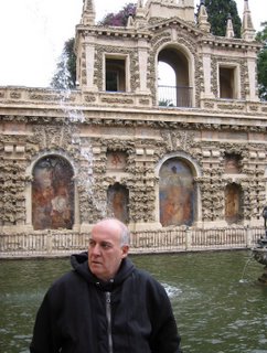
Sometimes it seems as though all the grandest sights of Sevilla were placed around the hotel-- from the beautiful Guadalquivir River to the Cathedral (the world's biggest gothic structure and the 3rd largest church in Europe) to the breathtaking 14th century Alcazar, Europe's oldest royal residence still in use. The rack rates are prohibitive (starting at around $500 for a double) but the Alfonso is a Westin Hotel and my old corporate travel agent was able to work wonders with a great discount and a spectacular upgrade. Everything about the hotel bespeaks value for your money, something I like. I mean it went beyond the most beautifully and luxuriously appointed rooms of the whole trip; the Alfonso even has the best, most professional, knowledgeable and empathetic concierge we ran into on the trip.

Everywhere you look within walking distance from the Alfonso is just spectacular. We ate up the tourist sites like the Cathedral and especially the Alcazar and loved walking around the Barrio de Santa Cruz (the old Jewish ghetto that is now a charming, vibrant functioning medieval town within the city). If you want the best in Seville, there is no other choice besides the Alfonso. Restaurant-wise, on the other hand, you have a lot of great choices-- chefs that are serious about catering to regular clients, not thinking about how to feed transients. On a couple of past trips I had tried the Egana Oriza, probably Sevilla's best eatery, and loved it but this time we decided to decided to give a less well-known place a shot. The Poncio (Calle Victoria 8 in the Triana District) is on the other side of the river and a bit of a trek by foot-- but that's partly why we chose it. Both of us love walking around cities and feeling the pulse of daily life.

The chef, Willy Moya, came to our table and we talked for a while about what we wanted in a general sense and he was able to recommend an incredible dinner for each of us. He's an inventive and brilliant chef and this was one of our best meals in Spain. Roland is still raving about some wild baked ice cream and olive oil concoction he scarfed down and was swearing he had just had the best wine in his life (although he tended to say that about every meal). I was pretty surprised that the cost was about half of what a meal like that is in a comparable Madrid restaurant.

The main bus stop is walking distance from the Alfonso and we took the bus to Algeciras to catch the ferry to Tangier. It was all easy to arrange and completely hassle-free.

Ke Zhan at Millenia Walk in Singapore

Chuanr

When we first walked up to this place (9 Raffles Boulevard #01-11/12/13, 6338-8583), we were a bit concerned, as they seemed to be doing much more business selling after-work drinks than they were selling food. And after having eaten there, I can see why: the food was kinda gross, with the mapo doufu lacking heat and the chuanr lacking spices. Sure, the decor was unique, and the dumplings were still half-edible, but I'd rather just go to Chinatown for this stuff.

Summits on Dhaulagiri!!


Yesterday it was reported that several climbers were making a speed attempt on the summit of Dhaulagiri, and the word today is that they were successful. MountEverest.net is reporting that Iñaki Ochoa and Jorge Egocheaga have topped out on the mountain.

Ochoa arrived at the summit at approximately 3 PM yesterday with his partner Egocheaga about 30 mintues behind. The Spaniards arrived at the top just 24 hours after leaving BC, an impressively fast climb to say the least. For Ochoa, this is his 12th 8000m peak, leaving him with just Kangchenjunga and Annapurna to go on completing the list. Congratulations and great work guys!

In other Himalaya news, the Spanish team on Annapurna has retreated to base camp following a fresh round of snow. Some of the team members are feeling under the weather, and it doesn't look like a summit window will open in the next few days. On Shisha Pangma, Andrew Lock is reporting that the summit push is on now that a the weather has cleard up some. And finally, on Cho Oyu, the Italians are setting off for C2 today with the hopes of improving their acclimatization efforts. The report is that the mornings are clear and beautiful, but the afternoons have continued to bring snow.

Jon Guido Bertelli: Last of Zapatistas

Photo © Jon Bertelli -All Rights Reserved

Jon Bertelli is an international photographer, who currently resides in Vancouver, British Columbia, but was raised in Florence and academically trained in the visual arts there and in Oslo.

He lived in Mexico in the late nineties, and documented the last surviving Zapatista fighters; the veterans of the 1910-20 Mexican Revolution of the South, led by the famed (and feared) Emiliano Zapata. While Pancho Villa's revolution was concentrated in the north of the country, Zapata and his insurgents represented the south.

Jon photographed the surviving insurgents; most of which were over 100 years old. These were idealistic men and women who sacrificed their well-being and lives to follow Zapata. Many were decorated as war heroes by the Mexican government, and some have been recognized internationally for their bravery.

You have the choice of seeing Jon's The Last of the Zapatistas on his website, or on FOTO8 where his portraits have been made into an audio-sideshow.

The audio track used is La Soldadera by Garcia-Pujol and Jimenez. While it's a beautiful and appropriately evocative piece, imagine if the audio of the elderly Zapatistas' voices, telling us a bit of their exploits, was also included!!

First Everest Summit of the Season!


MountEverest.net is reporting that Maxut Zhumayev & Vassily Pivtsov have topped out on Everest! This is the first summit of the season on Everest, and it was accomplished with out supplemental oxygen or Sherpa support as well. The pair left their high camp, at 7900m last night around 10 PM and radioed back to ABC at about 6 PM Chinese time from the summit.

The pair first attempted to reach the summit last week, but were turned back due to poor weather conditions. They returned to ABC on Friday, but launched another bid on Saturday. The two Kazakhs climb in alpine style, carrying all their necessary gear with them, and not using established camps. The report is that they reached the top just as HiMex's Sherpa team were laying down the last of the fixed ropes to the summit.

Currently they are descending the mountain on those ropes and will camp tonight above 8000m. Weather conditions are said to be good, with no high winds. Congratulations guys! What an amazing climb! I can't wait to hear more about it.

In other Summit news, word has come in that Denis Urubko is making a speed summit push tonight on Dhaulagiri as well. Denis is hoping to set a new summit speed record by beating the old time of 17 hours 15 minutes set back in 1995. Good luck Denis. We'll want to hear about your climb as well!

Update: Alan Arnette is now reporting that 5 Sherpas from the HiMex team actually summitted about a half-hour ahead of Maxut and Vassily. The Sherpa team was up near the summit setting fixed ropes and upon completion of that task, felt like continuing higher. This means that all the fixed ropes are now in place on the North side, and the way is clear, weather permitting, for teams to start to make their push. Alan notes that this is the exact same date that the Sherpas finished the task last year as well. Rumor has it the Olympic Torch practice run may go for the summit before weeks end.

Got it! Panasonic GF1 + 20mm f1.7 Lens

Having lost patience with Amazon's delivery system, and the fact that its delivery was now estimated to be between June 1 and June 14, I called yesterday and canceled my order. The customer service lady was extremely pleasant and nice, making me feel somewhat guilty for a while.

My guilt didn't last too long after I saw that Adorama had a Panasonic GF1 with a 20mm/F1.7 for $847 excluding NYC tax, but including some stuff like an 8 GB SD Sandisk memory card, a Lowepro carrying case (I much prefer my own pouches), a wonderful USB 2.0 SD card reader (like a memory stick), and a cleaning kit (of dubious use except for a nice lens brush).

I walked over to the store, got served by a lovely young woman (inexplicably wearing a scarf in NYC's heat) and had my new camera and accessories in under 10 minutes.

As with every camera and electronic gadgets I buy, I tried to work through the controls and settings without opening the manual. I got reasonably far, and was stumped a number of times, especially as I am used to a Canon "nomenclature". So I'll have to spend some time studying the manual after all.

I will soon test the GF1 and will post some of the street shots here. However, my first impressions holding it, shooting a few interior shots and so forth, gave me a sense that it's a solidly-built small camera. Not a point & shoot, not a rangefinder...but a hybrid in between the two.

Other Himalayan Climbers On The Move Too!


Everest isn't the only place where the action is this weekend. While teams on the Big Hill jockey for position and hope the good weather window stays open for a few more days, MountEerest.net is also reporting that the teams on Annapurna are also getting ready for their summit push.

There are two teams on the North side that are getting ready to leave BC and head up. The fixed ropes are in place and high camps are established, so now there is nothing left to do but head up to the summit. These teams include Iñaki Ochoa and Edurne Pasaban The weather isn't great at the moment however, with deep snow on the higher points of the mountain, and rain in BC. Anyone familiar with Annapurna knows that it's prone to avalanches, so lets hope those snows at higher elevation stay in place for these teams to make their run.

Teams have left Dhaulagiri after a rough season on the mountain that saw two climbers killed in their tent when an avalanche struck. Gerlinde Kaltenbrunner can't help but wonder how she managed to survive. She had to dig herself out of her tent, which was buried in snow as well, and she could have easily been swept off the mountain too. The rest of her climb was no piece of cake either. On her previous summit bid, she had to retreat in order to see her climbing partner, who got very sick, safely back to BC.

News from other Himalaya summit include a summit push by Ralf's Amical Team on Manaslu, a summit on Cho Oyu by the Kazakh team, and Italians Diego Giovannini and Massimiliano Gasperetti on Nuptse attempting to put up a new route.

Adventure Tech: New Tools For Would-Be Adventure Filmmakers

With the advent of tiny POV cameras over the past few years, adventure filmmaking has gone from an expensive, time consuming proposition to something that anyone with a laptop and a good camera can do. This week, aspiring filmmakers got a couple of new options to help in this process in the form of a new camera and an improved drone for capturing arial footage like never before.

First up, ION released their new Air Pro 3 WiFi camera, which brings an assortment of upgrades and improvements to the device. The new device has an improved 12 megapixel sensor that increases performance in lowlight conditions while continuing to shoot in full 1080p resolutions at 60 fps. Its ruggedized body is waterproof down to 49 feet (15 meters) and includes built-in image stabilization to help minimize shaking when worn on a helmet or mounted on the handlebars of a bike. It has a battery life of about 2.5 hours, which is a solid amount of time for a camera this small and an array of new mounting options are available to make this camera as versatile as possible. 

Additionally, the Air Pro 3's WiFi functionality makes it easier than ever to share videos online. The system even comes with 8GB of free cloud storage and can be paired with an app on an iOS or Android device for remote operation. 

The camera carries a price tag of $349.99 and begins shipping November 15. Preorders are available online.

Adventure filmmakers who want to add a new dimension to their next project will love the new offering from DJI, makers of the Phantom remote controlled drone systems. They've introduced the Phantom 2 Vision, which is unique in that it comes equipped with a camera right out of the box. Unlike previous models from DJI, the Vision has a built-in 14 megapixel camera that comes mounted on a tilting gimbal that can rotate 60º and has a wide 140º viewing area. A shock-aborbing bracket, built specifically for this camera, helps to reduce shaking and jitters that were an issue when  mountain your own camera on previous Phantom drones. The camera can also be paired with an iOS or Android device, allowing it to become a remote screen for the device, which the pilot can then use on the ground to see exactly what footage is being captured. 

DJI also improved the drone itself, giving it a greater battery life. It can now stay aloft for 25 minutes at a time. The drone also has improved stabilization for easier flight, even for beginners, although it all comes at a hefty cost. The Phantom 2 Vision will set you back $1199 when it goes on sale in a few weeks. The original Phantom, sans camera, is still available for just $479. 

Check out the Vision in action in the video below. Is it wrong that I kind of want one of these things?